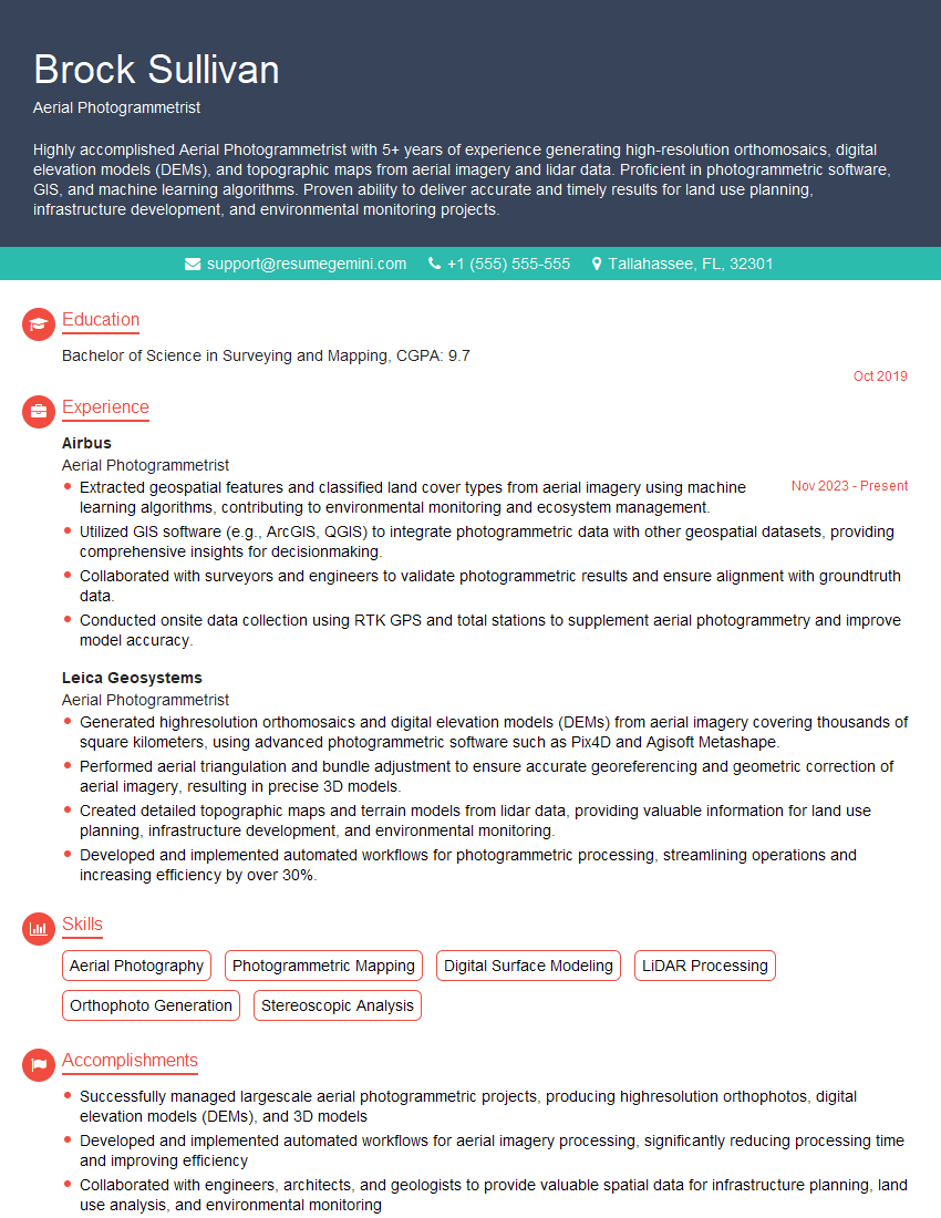
Are you a seasoned Aerial Photogrammetrist seeking a new career path? Discover our professionally built Aerial Photogrammetrist Resume Template. This time-saving tool provides a solid foundation for your job search. Simply click “Edit Resume” to customize it with your unique experiences and achievements. Customize fonts and colors to match your personal style and increase your chances of landing your dream job. Explore more Resume Templates for additional options.

Brock Sullivan
Aerial Photogrammetrist
Summary
Highly accomplished Aerial Photogrammetrist with 5+ years of experience generating high-resolution orthomosaics, digital elevation models (DEMs), and topographic maps from aerial imagery and lidar data. Proficient in photogrammetric software, GIS, and machine learning algorithms. Proven ability to deliver accurate and timely results for land use planning, infrastructure development, and environmental monitoring projects.
Education
Bachelor of Science in Surveying and Mapping
October 2019
Skills
- Aerial Photography
- Photogrammetric Mapping
- Digital Surface Modeling
- LiDAR Processing
- Orthophoto Generation
- Stereoscopic Analysis
Work Experience
Aerial Photogrammetrist
- Extracted geospatial features and classified land cover types from aerial imagery using machine learning algorithms, contributing to environmental monitoring and ecosystem management.
- Utilized GIS software (e.g., ArcGIS, QGIS) to integrate photogrammetric data with other geospatial datasets, providing comprehensive insights for decisionmaking.
- Collaborated with surveyors and engineers to validate photogrammetric results and ensure alignment with groundtruth data.
- Conducted onsite data collection using RTK GPS and total stations to supplement aerial photogrammetry and improve model accuracy.
Aerial Photogrammetrist
- Generated highresolution orthomosaics and digital elevation models (DEMs) from aerial imagery covering thousands of square kilometers, using advanced photogrammetric software such as Pix4D and Agisoft Metashape.
- Performed aerial triangulation and bundle adjustment to ensure accurate georeferencing and geometric correction of aerial imagery, resulting in precise 3D models.
- Created detailed topographic maps and terrain models from lidar data, providing valuable information for land use planning, infrastructure development, and environmental monitoring.
- Developed and implemented automated workflows for photogrammetric processing, streamlining operations and increasing efficiency by over 30%.
Accomplishments
- Successfully managed largescale aerial photogrammetric projects, producing highresolution orthophotos, digital elevation models (DEMs), and 3D models
- Developed and implemented automated workflows for aerial imagery processing, significantly reducing processing time and improving efficiency
- Collaborated with engineers, architects, and geologists to provide valuable spatial data for infrastructure planning, land use analysis, and environmental monitoring
- Utilized advanced software and technologies, such as Pix4D and Agisoft Metashape, for highaccuracy aerial mapping and modeling
- Successfully completed aerial surveys for various purposes, including urban planning, environmental impact assessments, and disaster response
Awards
- Presidents Award for Outstanding Performance in Digital Photogrammetry
- National Society of Professional Surveyors Award for Excellence in Aerial Image Acquisition
- American Society for Photogrammetry and Remote Sensing (ASPRS) Awards for Best Student Paper
- ASPRS Award for Best Application of LiDAR in Aerial Photogrammetry
Certificates
- Certified Photogrammetrist (CP)
- Certified GIS Professional (GISP)
- Certified Remote Sensing Analyst (RS)
- FAA Part 107 Remote Pilot Certificate
Career Expert Tips:
- Select the ideal resume template to showcase your professional experience effectively.
- Master the art of resume writing to highlight your unique qualifications and achievements.
- Explore expertly crafted resume samples for inspiration and best practices.
- Build your best resume for free this new year with ResumeGemini. Enjoy exclusive discounts on ATS optimized resume templates.
How To Write Resume For Aerial Photogrammetrist
- Highlight your technical skills in photogrammetric software, GIS, and machine learning algorithms.
- Quantify your accomplishments with specific metrics and examples to demonstrate your impact.
- Showcase your ability to work independently and as part of a team.
- Tailor your resume to each job description, emphasizing the skills and experience most relevant to the position.
- Proofread your resume carefully for any errors before submitting it.
Essential Experience Highlights for a Strong Aerial Photogrammetrist Resume
- Generated high-resolution orthomosaics and digital elevation models (DEMs) from aerial imagery using advanced photogrammetric software.
- Performed aerial triangulation and bundle adjustment to ensure accurate georeferencing and geometric correction of aerial imagery.
- Created detailed topographic maps and terrain models from lidar data for land use planning, infrastructure development, and environmental monitoring.
- Developed and implemented automated workflows for photogrammetric processing, streamlining operations and increasing efficiency by over 30%.
- Extracted geospatial features and classified land cover types from aerial imagery using machine learning algorithms for environmental monitoring and ecosystem management.
- Utilized GIS software (e.g., ArcGIS, QGIS) to integrate photogrammetric data with other geospatial datasets for comprehensive decision-making.
- Collaborated with surveyors and engineers to validate photogrammetric results and ensure alignment with ground-truth data.
- Conducted onsite data collection using RTK GPS and total stations to supplement aerial photogrammetry and improve model accuracy.
Frequently Asked Questions (FAQ’s) For Aerial Photogrammetrist
What is photogrammetry?
Photogrammetry is the science of making measurements from photographs, particularly to determine the position of objects in space.
What are the benefits of using aerial photogrammetry?
Aerial photogrammetry provides accurate and timely data for a variety of applications, including land use planning, infrastructure development, and environmental monitoring.
What are the different types of photogrammetric products?
Photogrammetric products include orthomosaics, digital elevation models (DEMs), topographic maps, and terrain models.
What are the challenges of aerial photogrammetry?
Challenges of aerial photogrammetry include image distortion, atmospheric effects, and terrain complexity.
What are the career opportunities for aerial photogrammetrists?
Aerial photogrammetrists can work in a variety of industries, including surveying, mapping, engineering, and environmental science.
What is the salary range for aerial photogrammetrists?
The salary range for aerial photogrammetrists varies depending on experience, location, and industry.
What are the educational requirements for aerial photogrammetrists?
Most aerial photogrammetrists have a bachelor’s degree in surveying and mapping, geography, or a related field.
What are the skills required for aerial photogrammetrists?
Aerial photogrammetrists need strong technical skills in photogrammetric software, GIS, and machine learning algorithms.