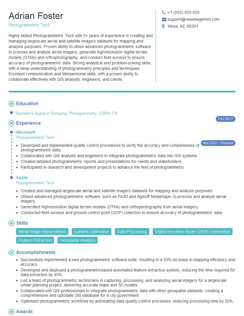
Are you a seasoned Photogrammetric Tech seeking a new career path? Discover our professionally built Photogrammetric Tech Resume Template. This time-saving tool provides a solid foundation for your job search. Simply click “Edit Resume” to customize it with your unique experiences and achievements. Customize fonts and colors to match your personal style and increase your chances of landing your dream job. Explore more Resume Templates for additional options.

Adrian Foster
Photogrammetric Tech
Summary
Highly skilled Photogrammetric Tech with 5+ years of experience in creating and managing largescale aerial and satellite imagery datasets for mapping and analysis purposes. Proven ability to utilize advanced photogrammetric software to process and analyze aerial imagery, generate highresolution digital terrain models (DTMs) and orthophotography, and conduct field surveys to ensure accuracy of photogrammetric data. Strong analytical and problem-solving skills, with a deep understanding of photogrammetry principles and techniques. Excellent communication and interpersonal skills, with a proven ability to collaborate effectively with GIS analysts, engineers, and clients.
Education
Bachelor’s degree in Surveying, Photogrammetry
February 2017
Skills
- Aerial Image Interpretation
- Camera Calibration
- Data Processing
- Digital Elevation Model (DEM) Generation
- Feature Extraction
- Geospatial Analysis
Work Experience
Photogrammetric Tech
- Developed and implemented quality control procedures to verify the accuracy and completeness of photogrammetric data.
- Collaborated with GIS analysts and engineers to integrate photogrammetric data into GIS systems.
- Created detailed photogrammetric reports and presentations for clients and stakeholders.
- Participated in research and development projects to advance the field of photogrammetry.
Photogrammetric Tech
- Created and managed largescale aerial and satellite imagery datasets for mapping and analysis purposes.
- Utilized advanced photogrammetric software, such as Pix4D and Agisoft Metashape, to process and analyze aerial imagery.
- Generated highresolution digital terrain models (DTMs) and orthophotography from aerial imagery.
- Conducted field surveys and ground control point (GCP) collection to ensure accuracy of photogrammetric data.
Accomplishments
- Successfully implemented a new photogrammetric software suite, resulting in a 30% increase in mapping efficiency and accuracy.
- Developed and deployed a photogrammetricbased automated feature extraction system, reducing the time required for data extraction by 45%.
- Led a team of photogrammetric technicians in capturing, processing, and analyzing aerial imagery for a largescale urban planning project, delivering accurate maps and 3D models.
- Collaborated with GIS professionals to integrate photogrammetric data with other geospatial datasets, creating a comprehensive and uptodate GIS database for a city government.
- Optimized photogrammetric workflows by automating data quality control processes, reducing processing time by 20%.
Awards
- Received the American Society for Photogrammetry and Remote Sensing (ASPRS) Presidential Citation for outstanding contributions to the field.
- Honored with the International Society for Photogrammetry and Remote Sensing (ISPRS) Young Professional Award for innovative research in photogrammetric mapping.
- Recognized by the Society of American Military Engineers (SAME) with the Outstanding Young Engineer Award for developing a novel photogrammetric system for military applications.
- Awarded the National GeospatialIntelligence Agency (NGA) Excellence Award for exceptional performance in photogrammetric data production.
Certificates
- American Society for Photogrammetry and Remote Sensing (ASPRS) Certified Photogrammetrist
- Certified Geographic Information Systems Professional (GISP)
- Federal Emergency Management Agency (FEMA) Certified Floodplain Manager
- National Society of Professional Surveyors (NSPS) Certified Surveying Technician
Career Expert Tips:
- Select the ideal resume template to showcase your professional experience effectively.
- Master the art of resume writing to highlight your unique qualifications and achievements.
- Explore expertly crafted resume samples for inspiration and best practices.
- Build your best resume for free this new year with ResumeGemini. Enjoy exclusive discounts on ATS optimized resume templates.
How To Write Resume For Photogrammetric Tech
Highlight your experience and skills.
Make sure to list all of your relevant experience and skills in your resume, including your experience with photogrammetric software and your ability to interpret aerial imagery.Tailor your resume to the job you’re applying for.
Take the time to read the job description carefully and tailor your resume to the specific requirements of the job.Proofread your resume carefully.
Make sure your resume is free of errors before you submit it.Use a professional resume template.
There are many professional resume templates available online that can help you create a polished and professional resume.Get feedback from others.
Ask a friend, family member, or career counselor to review your resume and give you feedback.
Essential Experience Highlights for a Strong Photogrammetric Tech Resume
- Created and managed largescale aerial and satellite imagery datasets for mapping and analysis purposes.
- Utilized advanced photogrammetric software, such as Pix4D and Agisoft Metashape, to process and analyze aerial imagery.
- Generated highresolution digital terrain models (DTMs) and orthophotography from aerial imagery.
- Conducted field surveys and ground control point (GCP) collection to ensure accuracy of photogrammetric data.
- Developed and implemented quality control procedures to verify the accuracy and completeness of photogrammetric data.
Frequently Asked Questions (FAQ’s) For Photogrammetric Tech
What is photogrammetry?
Photogrammetry is the science of making measurements from photographs, and is used to create maps, terrain models, and other representations of the world.
What are the different types of photogrammetry?
There are two main types of photogrammetry: close-range photogrammetry and aerial photogrammetry.
What are the uses of photogrammetry?
Photogrammetry is used in a wide variety of applications, including surveying, mapping, architecture, engineering, and construction.
What are the benefits of using photogrammetry?
Photogrammetry offers a number of benefits over traditional surveying methods, including accuracy, speed, and cost-effectiveness.
What are the challenges of using photogrammetry?
Photogrammetry can be challenging in certain situations, such as when there is poor lighting or when the subject is moving.
What is the future of photogrammetry?
The future of photogrammetry is bright, with new technologies and applications being developed all the time.
What are the career opportunities in photogrammetry?
There are many career opportunities in photogrammetry, including positions in government, private industry, and academia.
How can I learn more about photogrammetry?
There are many resources available to learn more about photogrammetry, including books, articles, and online courses.