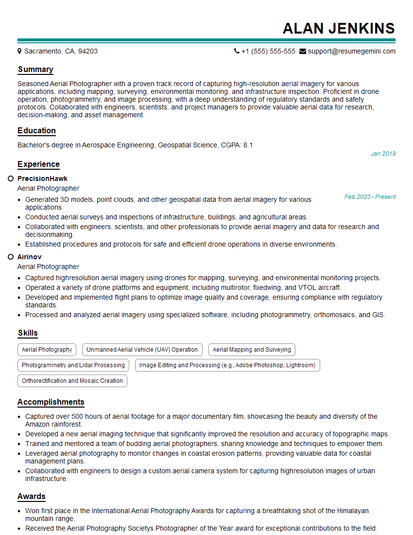
Are you a seasoned Aerial Photographer seeking a new career path? Discover our professionally built Aerial Photographer Resume Template. This time-saving tool provides a solid foundation for your job search. Simply click “Edit Resume” to customize it with your unique experiences and achievements. Customize fonts and colors to match your personal style and increase your chances of landing your dream job. Explore more Resume Templates for additional options.

Alan Jenkins
Aerial Photographer
Summary
Seasoned Aerial Photographer with a proven track record of capturing high-resolution aerial imagery for various applications, including mapping, surveying, environmental monitoring, and infrastructure inspection. Proficient in drone operation, photogrammetry, and image processing, with a deep understanding of regulatory standards and safety protocols. Collaborated with engineers, scientists, and project managers to provide valuable aerial data for research, decision-making, and asset management.
Education
Bachelor’s degree in Aerospace Engineering, Geospatial Science
January 2019
Skills
- Aerial Photography
- Unmanned Aerial Vehicle (UAV) Operation
- Aerial Mapping and Surveying
- Photogrammetry and Lidar Processing
- Image Editing and Processing (e.g., Adobe Photoshop, Lightroom)
- Orthorectification and Mosaic Creation
Work Experience
Aerial Photographer
- Generated 3D models, point clouds, and other geospatial data from aerial imagery for various applications.
- Conducted aerial surveys and inspections of infrastructure, buildings, and agricultural areas.
- Collaborated with engineers, scientists, and other professionals to provide aerial imagery and data for research and decisionmaking.
- Established procedures and protocols for safe and efficient drone operations in diverse environments.
Aerial Photographer
- Captured highresolution aerial imagery using drones for mapping, surveying, and environmental monitoring projects.
- Operated a variety of drone platforms and equipment, including multirotor, fixedwing, and VTOL aircraft.
- Developed and implemented flight plans to optimize image quality and coverage, ensuring compliance with regulatory standards.
- Processed and analyzed aerial imagery using specialized software, including photogrammetry, orthomosaics, and GIS.
Accomplishments
- Captured over 500 hours of aerial footage for a major documentary film, showcasing the beauty and diversity of the Amazon rainforest.
- Developed a new aerial imaging technique that significantly improved the resolution and accuracy of topographic maps.
- Trained and mentored a team of budding aerial photographers, sharing knowledge and techniques to empower them.
- Leveraged aerial photography to monitor changes in coastal erosion patterns, providing valuable data for coastal management plans.
- Collaborated with engineers to design a custom aerial camera system for capturing highresolution images of urban infrastructure.
Awards
- Won first place in the International Aerial Photography Awards for capturing a breathtaking shot of the Himalayan mountain range.
- Received the Aerial Photography Societys Photographer of the Year award for exceptional contributions to the field.
- Honored with the National Geographic Societys Explorers Grant to support a groundbreaking aerial photography project in Antarctica.
- Recognized by the International Association of Aerial Photographers for innovative use of drones in capturing unique aerial perspectives.
Certificates
- FAA Part 107 Remote Pilot Certificate
- Certified Remote Pilot (CRP)
- UAS Safety and Risk Management Certificate
- Photogrammetry and Remote Sensing Certificate
Career Expert Tips:
- Select the ideal resume template to showcase your professional experience effectively.
- Master the art of resume writing to highlight your unique qualifications and achievements.
- Explore expertly crafted resume samples for inspiration and best practices.
- Build your best resume for free this new year with ResumeGemini. Enjoy exclusive discounts on ATS optimized resume templates.
How To Write Resume For Aerial Photographer
- Highlight your technical skills and proficiency in drone operation, photogrammetry, and image processing software.
- Quantify your accomplishments and provide specific examples of projects where you made a significant contribution.
- Showcase your understanding of regulatory standards and safety protocols related to drone operations.
- Emphasize your ability to collaborate effectively with engineers, scientists, and other professionals.
- Include a portfolio or online gallery showcasing your aerial photography and geospatial data products.
Essential Experience Highlights for a Strong Aerial Photographer Resume
- Captured high-resolution aerial imagery using drones for mapping, surveying, and environmental monitoring projects.
- Operated a variety of drone platforms and equipment, including multirotor, fixed-wing, and VTOL aircraft.
- Developed and implemented flight plans to optimize image quality and coverage, ensuring compliance with regulatory standards.
- Processed and analyzed aerial imagery using specialized software, including photogrammetry, orthomosaics, and GIS.
- Generated 3D models, point clouds, and other geospatial data from aerial imagery for various applications.
- Conducted aerial surveys and inspections of infrastructure, buildings, and agricultural areas.
Frequently Asked Questions (FAQ’s) For Aerial Photographer
What are the essential skills required for an Aerial Photographer?
Essential skills include drone operation, aerial photography, photogrammetry, image processing, and knowledge of regulatory standards.
What are the primary applications of aerial photography?
Aerial photography is used for mapping, surveying, environmental monitoring, infrastructure inspection, and precision agriculture.
What are the career opportunities for Aerial Photographers?
Career opportunities include working for aerial mapping companies, construction firms, government agencies, and environmental organizations.
What are the safety considerations when operating drones?
Safety considerations include obtaining necessary licenses and permits, conducting thorough pre-flight inspections, maintaining line of sight, and adhering to altitude and airspace regulations.
What is the potential salary range for Aerial Photographers?
Salary ranges vary depending on experience, location, and industry, but typically fall between $50,000 and $100,000 per year.
What is the future outlook for the Aerial Photography industry?
The industry is projected to grow significantly as drones become more accessible and affordable, and as demand for aerial data increases in various sectors.