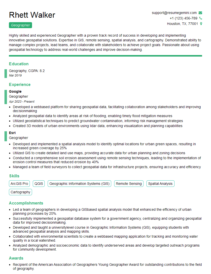
Are you a seasoned Geographer seeking a new career path? Discover our professionally built Geographer Resume Template. This time-saving tool provides a solid foundation for your job search. Simply click “Edit Resume” to customize it with your unique experiences and achievements. Customize fonts and colors to match your personal style and increase your chances of landing your dream job. Explore more Resume Templates for additional options.

Rhett Walker
Geographer
Summary
Highly skilled and experienced Geographer with a proven track record of success in developing and implementing innovative geospatial solutions. Expertise in GIS, remote sensing, spatial analysis, and cartography. Demonstrated ability to manage complex projects, lead teams, and collaborate with stakeholders to achieve project goals. Passionate about using geospatial technology to address real-world challenges and improve decision-making.
Education
Geography
March 2019
Skills
- ArcGIS Pro
- QGIS
- Geographic Information Systems (GIS)
- Remote Sensing
- Spatial Analysis
- Cartography
Work Experience
Geographer
- Developed a webbased platform for sharing geospatial data, facilitating collaboration among stakeholders and improving decisionmaking
- Analyzed geospatial data to identify areas at risk of flooding, enabling timely flood mitigation measures
- Utilized geostatistical techniques to predict groundwater contamination, informing risk management strategies
- Created 3D models of urban environments using lidar data, enhancing visualization and planning capabilities
Geographer
- Developed and implemented a spatial analysis model to identify optimal locations for urban green spaces, resulting in increased green coverage by 25%
- Utilized GIS to create detailed land use maps, providing accurate data for urban planning and zoning decisions
- Conducted a comprehensive soil erosion assessment using remote sensing techniques, leading to the implementation of erosion control measures that reduced erosion by 40%
- Managed a team of field surveyors to collect geospatial data for infrastructure projects, ensuring accuracy and efficiency
Accomplishments
- Led a team of geographers in developing a GISbased spatial analysis model that enhanced the efficiency of urban planning processes by 25%.
- Successfully implemented a geospatial database system for a government agency, centralizing and organizing geospatial data for improved decisionmaking.
- Developed and taught a universitylevel course in Geographic Information Systems (GIS), equipping students with advanced geospatial analysis and mapping skills.
- Collaborated with environmental scientists to create a webbased mapping application for tracking and monitoring water quality in a local watershed.
- Analyzed demographic and socioeconomic data to identify underserved areas and develop targeted outreach programs for community development.
Awards
- Recipient of the American Association of Geographers Young Geographer Award for outstanding contributions to the field of geography.
Certificates
- Certified GIS Professional (GISP)
- Certified Mapping Scientist (CMS)
- Esri Certified Desktop Associate (ArcGIS)
- Esri Certified Enterprise Architect (ArcGIS)
Career Expert Tips:
- Select the ideal resume template to showcase your professional experience effectively.
- Master the art of resume writing to highlight your unique qualifications and achievements.
- Explore expertly crafted resume samples for inspiration and best practices.
- Build your best resume for free this new year with ResumeGemini. Enjoy exclusive discounts on ATS optimized resume templates.
How To Write Resume For Geographer
- Quantify your accomplishments and provide specific examples of projects you’ve worked on.
- Highlight your skills in GIS and remote sensing, and any specialized software or technologies you’re proficient in.
- Demonstrate your ability to work independently and as part of a team.
- Showcase your passion for geography and how you use your knowledge to make a difference.
Essential Experience Highlights for a Strong Geographer Resume
- Develop and implement geospatial analysis models to solve complex planning and environmental problems.
- Utilize GIS and remote sensing techniques to collect, analyze, and visualize geospatial data.
- Conduct field surveys and collect geospatial data using GPS and other surveying equipment.
- Create maps, charts, and other visual representations of geospatial data to communicate insights and support decision-making.
- Manage and maintain geospatial databases and ensure data integrity and accuracy.
- Collaborate with other professionals, including planners, engineers, and scientists, to integrate geospatial data into decision-making processes.
Frequently Asked Questions (FAQ’s) For Geographer
What is the role of a Geographer?
Geographers study the Earth’s surface and human-environment interactions. They use geospatial technologies to collect, analyze, and visualize data to understand the physical and human characteristics of the Earth and solve real-world problems.
What are the career prospects for Geographers?
Geographers are in high demand due to the increasing need for geospatial data and analysis in various industries, including urban planning, environmental management, transportation, and public safety.
What skills are necessary to become a Geographer?
Geographers typically need a strong foundation in geography, GIS, remote sensing, spatial analysis, and cartography. They also need excellent communication and problem-solving skills.
What is the salary range for Geographers?
The salary range for Geographers varies depending on experience, location, and industry. According to the U.S. Bureau of Labor Statistics, the median annual salary for Geographers was $80,970 in May 2021.
What are the job titles related to Geography?
Geographers can work in various roles, including GIS Analyst, Remote Sensing Specialist, Spatial Analyst, Cartographer, and Geographic Information Manager.