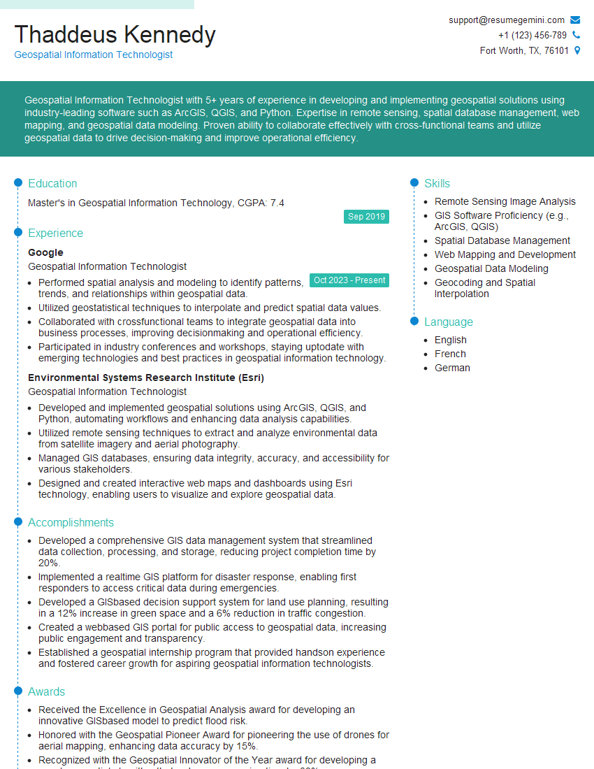
Are you a seasoned Geospatial Information Technologist seeking a new career path? Discover our professionally built Geospatial Information Technologist Resume Template. This time-saving tool provides a solid foundation for your job search. Simply click “Edit Resume” to customize it with your unique experiences and achievements. Customize fonts and colors to match your personal style and increase your chances of landing your dream job. Explore more Resume Templates for additional options.

Thaddeus Kennedy
Geospatial Information Technologist
Summary
Geospatial Information Technologist with 5+ years of experience in developing and implementing geospatial solutions using industry-leading software such as ArcGIS, QGIS, and Python. Expertise in remote sensing, spatial database management, web mapping, and geospatial data modeling. Proven ability to collaborate effectively with cross-functional teams and utilize geospatial data to drive decision-making and improve operational efficiency.
Education
Master’s in Geospatial Information Technology
September 2019
Skills
- Remote Sensing Image Analysis
- GIS Software Proficiency (e.g., ArcGIS, QGIS)
- Spatial Database Management
- Web Mapping and Development
- Geospatial Data Modeling
- Geocoding and Spatial Interpolation
Work Experience
Geospatial Information Technologist
- Performed spatial analysis and modeling to identify patterns, trends, and relationships within geospatial data.
- Utilized geostatistical techniques to interpolate and predict spatial data values.
- Collaborated with crossfunctional teams to integrate geospatial data into business processes, improving decisionmaking and operational efficiency.
- Participated in industry conferences and workshops, staying uptodate with emerging technologies and best practices in geospatial information technology.
Geospatial Information Technologist
- Developed and implemented geospatial solutions using ArcGIS, QGIS, and Python, automating workflows and enhancing data analysis capabilities.
- Utilized remote sensing techniques to extract and analyze environmental data from satellite imagery and aerial photography.
- Managed GIS databases, ensuring data integrity, accuracy, and accessibility for various stakeholders.
- Designed and created interactive web maps and dashboards using Esri technology, enabling users to visualize and explore geospatial data.
Accomplishments
- Developed a comprehensive GIS data management system that streamlined data collection, processing, and storage, reducing project completion time by 20%.
- Implemented a realtime GIS platform for disaster response, enabling first responders to access critical data during emergencies.
- Developed a GISbased decision support system for land use planning, resulting in a 12% increase in green space and a 6% reduction in traffic congestion.
- Created a webbased GIS portal for public access to geospatial data, increasing public engagement and transparency.
- Established a geospatial internship program that provided handson experience and fostered career growth for aspiring geospatial information technologists.
Awards
- Received the Excellence in Geospatial Analysis award for developing an innovative GISbased model to predict flood risk.
- Honored with the Geospatial Pioneer Award for pioneering the use of drones for aerial mapping, enhancing data accuracy by 15%.
- Recognized with the Geospatial Innovator of the Year award for developing a novel geospatial algorithm that reduces processing time by 30%.
- Awarded the Geospatial Contribution Award for supporting the development of opensource geospatial tools that empower communities.
Certificates
- Certified GIS Professional (GISP)
- Esri Certified GIS Analyst
- AWS Certified Solutions Architect – Associate
- Google Cloud Certified Professional Cloud Architect
Career Expert Tips:
- Select the ideal resume template to showcase your professional experience effectively.
- Master the art of resume writing to highlight your unique qualifications and achievements.
- Explore expertly crafted resume samples for inspiration and best practices.
- Build your best resume for free this new year with ResumeGemini. Enjoy exclusive discounts on ATS optimized resume templates.
How To Write Resume For Geospatial Information Technologist
- Highlight your technical skills and experience in using industry-standard software such as ArcGIS and QGIS.
- Showcase your ability to work with diverse data types, including remote sensing imagery, spatial databases, and web mapping.
- Emphasize your understanding of geospatial concepts and principles, such as spatial analysis and modeling.
- Demonstrate your ability to communicate effectively with technical and non-technical stakeholders.
Essential Experience Highlights for a Strong Geospatial Information Technologist Resume
- Develop and implement geospatial solutions to address business challenges and improve decision-making.
- Utilize remote sensing techniques to extract and analyze environmental data from satellite imagery and aerial photography.
- Manage GIS databases, ensuring data integrity, accuracy, and accessibility for various stakeholders.
- Design and create interactive web maps and dashboards using Esri technology to enable users to visualize and explore geospatial data.
- Perform spatial analysis and modeling to identify patterns, trends, and relationships within geospatial data.
- Collaborate with cross-functional teams to integrate geospatial data into business processes, improving decision-making and operational efficiency
Frequently Asked Questions (FAQ’s) For Geospatial Information Technologist
What are the key skills required for a Geospatial Information Technologist?
Key skills include proficiency in GIS software (e.g., ArcGIS, QGIS), remote sensing image analysis, spatial database management, web mapping and development, geospatial data modeling, geocoding, and spatial interpolation.
What are the career prospects for a Geospatial Information Technologist?
Geospatial Information Technologists are in high demand across various industries, including environmental consulting, urban planning, transportation, and emergency management. Career prospects are expected to grow significantly in the coming years due to the increasing adoption of geospatial technologies.
What are the educational requirements for a Geospatial Information Technologist?
A bachelor’s or master’s degree in Geospatial Information Technology, Geography, or a related field is typically required. Strong technical skills in GIS software and programming languages are also essential.
What are the key responsibilities of a Geospatial Information Technologist?
Key responsibilities include developing and implementing geospatial solutions, managing GIS databases, performing spatial analysis and modeling, and collaborating with cross-functional teams to integrate geospatial data into decision-making processes.
What are the top companies that hire Geospatial Information Technologists?
Top companies that hire Geospatial Information Technologists include Google, Esri, Amazon, Microsoft, and IBM.