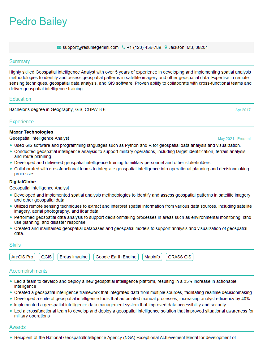
Are you a seasoned Geospatial Intelligence Analyst seeking a new career path? Discover our professionally built Geospatial Intelligence Analyst Resume Template. This time-saving tool provides a solid foundation for your job search. Simply click “Edit Resume” to customize it with your unique experiences and achievements. Customize fonts and colors to match your personal style and increase your chances of landing your dream job. Explore more Resume Templates for additional options.

Pedro Bailey
Geospatial Intelligence Analyst
Summary
Highly skilled Geospatial Intelligence Analyst with over 5 years of experience in developing and implementing spatial analysis methodologies to identify and assess geospatial patterns in satellite imagery and other geospatial data. Expertise in remote sensing techniques, geospatial data analysis, and GIS software. Proven ability to collaborate with cross-functional teams and deliver geospatial intelligence training.
Education
Bachelor’s degree in Geography, GIS
April 2017
Skills
- ArcGIS Pro
- QGIS
- Erdas Imagine
- Google Earth Engine
- MapInfo
- GRASS GIS
Work Experience
Geospatial Intelligence Analyst
- Used GIS software and programming languages such as Python and R for geospatial data analysis and visualization.
- Conducted geospatial intelligence analysis to support military operations, including target identification, terrain analysis, and route planning.
- Developed and delivered geospatial intelligence training to military personnel and other stakeholders.
- Collaborated with crossfunctional teams to integrate geospatial intelligence into operational planning and decisionmaking processes.
Geospatial Intelligence Analyst
- Developed and implemented spatial analysis methodologies to identify and assess geospatial patterns in satellite imagery and other geospatial data.
- Utilized remote sensing techniques to extract and interpret spatial information from various data sources, including satellite imagery, aerial photography, and lidar data.
- Performed geospatial data analysis to support decisionmaking processes in areas such as environmental monitoring, land use planning, and disaster response.
- Created and maintained geospatial databases and geospatial models to support analysis and visualization of geospatial data.
Accomplishments
- Led a team to develop and deploy a new geospatial intelligence platform, resulting in a 35% increase in actionable intelligence
- Created a geospatial intelligence framework that integrated data from multiple sources, facilitating realtime decisionmaking
- Developed a suite of geospatial intelligence tools that automated manual processes, increasing analyst efficiency by 40%
- Implemented a geospatial intelligence data management system that improved data accessibility and security
- Led a crossfunctional team to develop and deploy a geospatial intelligence solution that improved situational awareness for military operations
Awards
- Recipient of the National GeospatialIntelligence Agency (NGA) Exceptional Achievement Medal for development of innovative geospatial intelligence solutions
- Recognized by the International Society for Photogrammetry and Remote Sensing (ISPRS) for groundbreaking research in geospatial intelligence techniques
- Awarded the Directors Challenge Coin for exceptional contributions to geospatial intelligence analysis
- Received the NGA Meritorious Service Medal for exceptional leadership and innovation in geospatial intelligence
Certificates
- Certified GIS Professional (GISP)
- Certified Geospatial Intelligence Analyst (CGIA)
- Certified Mapping Scientist (CMS)
- Certified Photogrammetrist (CP)
Career Expert Tips:
- Select the ideal resume template to showcase your professional experience effectively.
- Master the art of resume writing to highlight your unique qualifications and achievements.
- Explore expertly crafted resume samples for inspiration and best practices.
- Build your best resume for free this new year with ResumeGemini. Enjoy exclusive discounts on ATS optimized resume templates.
How To Write Resume For Geospatial Intelligence Analyst
- Highlight your skills in spatial analysis, remote sensing, and GIS software.
- Showcase your experience in applying geospatial intelligence to solve real-world problems.
- Demonstrate your ability to work independently and as part of a team.
- Tailor your resume to the specific job requirements by using relevant keywords.
Essential Experience Highlights for a Strong Geospatial Intelligence Analyst Resume
- Develop and implement spatial analysis methodologies to identify and assess geospatial patterns in satellite imagery and other geospatial data.
- Utilize remote sensing techniques to extract and interpret spatial information from various data sources, including satellite imagery, aerial photography, and lidar data.
- Perform geospatial data analysis to support decision-making processes in areas such as environmental monitoring, land use planning, and disaster response.
- Create and maintain geospatial databases and geospatial models to support analysis and visualization of geospatial data.
- Use GIS software and programming languages such as Python and R for geospatial data analysis and visualization.
- Conducted geospatial intelligence analysis to support military operations, including target identification, terrain analysis, and route planning.
- Developed and delivered geospatial intelligence training to military personnel and other stakeholders.
Frequently Asked Questions (FAQ’s) For Geospatial Intelligence Analyst
What is the role of a Geospatial Intelligence Analyst?
Geospatial Intelligence Analysts use geospatial data and technologies to provide insights and support decision-making in various fields.
What skills are required to become a Geospatial Intelligence Analyst?
Skills in spatial analysis, remote sensing, GIS software, and programming are essential for Geospatial Intelligence Analysts.
What industries hire Geospatial Intelligence Analysts?
Geospatial Intelligence Analysts are employed in various industries, including defense, intelligence, environmental consulting, and urban planning.
What is the career outlook for Geospatial Intelligence Analysts?
The career outlook for Geospatial Intelligence Analysts is positive due to the increasing demand for geospatial data and analysis.
How can I become a Geospatial Intelligence Analyst?
To become a Geospatial Intelligence Analyst, you typically need a bachelor’s degree in Geography, GIS, or a related field, along with experience in geospatial data analysis and GIS software.
What are the challenges of being a Geospatial Intelligence Analyst?
Challenges for Geospatial Intelligence Analysts include working with large and complex datasets, staying up-to-date with new technologies, and maintaining ethical standards when handling sensitive data.
What are the benefits of being a Geospatial Intelligence Analyst?
Geospatial Intelligence Analysts have the opportunity to use their skills to solve real-world problems, contribute to decision-making, and work with cutting-edge technologies.
What is the salary range for Geospatial Intelligence Analysts?
The salary range for Geospatial Intelligence Analysts varies depending on experience, location, and industry.