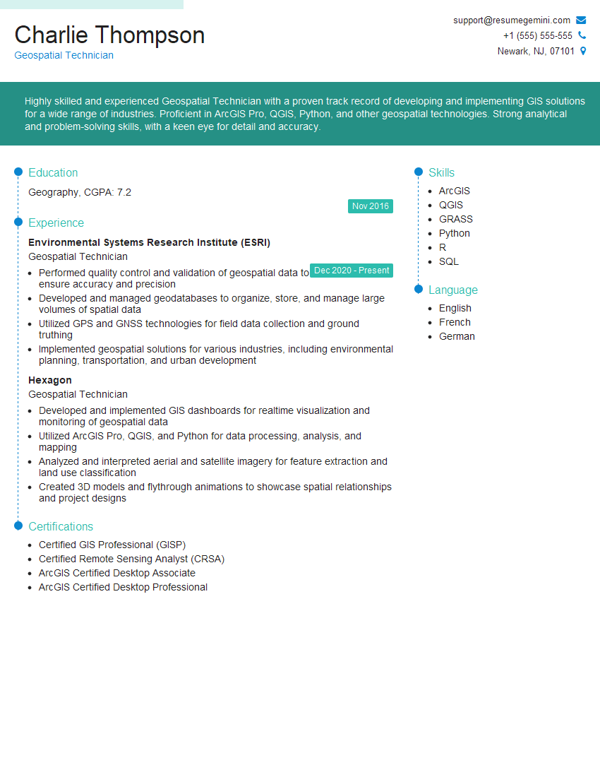
Are you a seasoned Geospatial Technician seeking a new career path? Discover our professionally built Geospatial Technician Resume Template. This time-saving tool provides a solid foundation for your job search. Simply click “Edit Resume” to customize it with your unique experiences and achievements. Customize fonts and colors to match your personal style and increase your chances of landing your dream job. Explore more Resume Templates for additional options.

Charlie Thompson
Geospatial Technician
Summary
Highly skilled and experienced Geospatial Technician with a proven track record of developing and implementing GIS solutions for a wide range of industries. Proficient in ArcGIS Pro, QGIS, Python, and other geospatial technologies. Strong analytical and problem-solving skills, with a keen eye for detail and accuracy.
Education
Geography
November 2016
Skills
- ArcGIS
- QGIS
- GRASS
- Python
- R
- SQL
Work Experience
Geospatial Technician
- Performed quality control and validation of geospatial data to ensure accuracy and precision
- Developed and managed geodatabases to organize, store, and manage large volumes of spatial data
- Utilized GPS and GNSS technologies for field data collection and ground truthing
- Implemented geospatial solutions for various industries, including environmental planning, transportation, and urban development
Geospatial Technician
- Developed and implemented GIS dashboards for realtime visualization and monitoring of geospatial data
- Utilized ArcGIS Pro, QGIS, and Python for data processing, analysis, and mapping
- Analyzed and interpreted aerial and satellite imagery for feature extraction and land use classification
- Created 3D models and flythrough animations to showcase spatial relationships and project designs
Certificates
- Certified GIS Professional (GISP)
- Certified Remote Sensing Analyst (CRSA)
- ArcGIS Certified Desktop Associate
- ArcGIS Certified Desktop Professional
Languages
- English
- French
- German
Career Expert Tips:
- Select the ideal resume template to showcase your professional experience effectively.
- Master the art of resume writing to highlight your unique qualifications and achievements.
- Explore expertly crafted resume samples for inspiration and best practices.
- Build your best resume for free this new year with ResumeGemini. Enjoy exclusive discounts on ATS optimized resume templates.
How To Write Resume For Geospatial Technician
- Highlight your proficiency in industry-standard software such as ArcGIS, QGIS, and Python.
- Showcase your ability to analyze and interpret geospatial data to extract meaningful insights.
- Emphasize your experience in developing and implementing GIS solutions for real-world problems.
- Quantify your accomplishments whenever possible to demonstrate the impact of your work.
Essential Experience Highlights for a Strong Geospatial Technician Resume
- Developed and implemented GIS dashboards for realtime visualization and monitoring of geospatial data.
- Utilized ArcGIS Pro, QGIS, and Python for data processing, analysis, and mapping.
- Analyzed and interpreted aerial and satellite imagery for feature extraction and land use classification.
- Created 3D models and flythrough animations to showcase spatial relationships and project designs.
- Performed quality control and validation of geospatial data to ensure accuracy and precision.
- Developed and managed geodatabases to organize, store, and manage large volumes of spatial data.
- Utilized GPS and GNSS technologies for field data collection and ground truthing.
Frequently Asked Questions (FAQ’s) For Geospatial Technician
What is a Geospatial Technician?
A Geospatial Technician is a professional who uses geospatial technologies to collect, analyze, and interpret data to create maps, models, and other visualizations that help decision-makers understand and solve complex problems.
What skills are required to be a successful Geospatial Technician?
Successful Geospatial Technicians typically have a strong foundation in geography, computer science, and mathematics. They are also proficient in GIS software such as ArcGIS, QGIS, and Python.
What are the career prospects for Geospatial Technicians?
Geospatial Technicians are in high demand due to the increasing use of geospatial technologies in various industries. They can work in a variety of settings, including government agencies, private companies, and non-profit organizations.
What is the salary range for Geospatial Technicians?
The salary range for Geospatial Technicians varies depending on their experience, skills, and location. According to the U.S. Bureau of Labor Statistics, the median annual salary for Geospatial Technicians was $67,210 in May 2021.
What is the job outlook for Geospatial Technicians?
The job outlook for Geospatial Technicians is expected to be excellent over the next few years. The increasing use of geospatial technologies in various industries is driving the demand for qualified professionals.
How can I become a Geospatial Technician?
There are several ways to become a Geospatial Technician. One common path is to earn a degree in geography, computer science, or a related field. You can also gain experience through internships, volunteer work, or self-study.