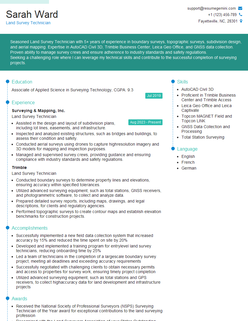
Are you a seasoned Land Survey Technician seeking a new career path? Discover our professionally built Land Survey Technician Resume Template. This time-saving tool provides a solid foundation for your job search. Simply click “Edit Resume” to customize it with your unique experiences and achievements. Customize fonts and colors to match your personal style and increase your chances of landing your dream job. Explore more Resume Templates for additional options.

Sarah Ward
Land Survey Technician
Summary
Seasoned Land Survey Technician with 5+ years of experience in boundary surveys, topographic surveys, subdivision design, and aerial mapping. Expertise in AutoCAD Civil 3D, Trimble Business Center, Leica Geo Office, and GNSS data collection. Proven ability to manage survey crews and ensure adherence to industry standards and safety regulations.
Seeking a challenging role where I can leverage my technical skills and contribute to the successful completion of surveying projects.
Education
Associate of Applied Science in Surveying Technology
July 2019
Skills
- AutoCAD Civil 3D
- Proficient in Trimble Business Center and Trimble Access
- Leica Geo Office and Leica Captivate
- Topcon MAGNET Field and Topcon LINK
- GNSS Data Collection and Processing
- Total Station Surveying
Work Experience
Land Survey Technician
- Assisted in the design and layout of subdivision plans, including lot lines, easements, and infrastructure.
- Inspected and analyzed existing structures, such as bridges and buildings, to assess their condition and safety.
- Conducted aerial surveys using drones to capture highresolution imagery and 3D models for mapping and inspection purposes.
- Managed and supervised survey crews, providing guidance and ensuring compliance with industry standards and safety regulations.
Land Survey Technician
- Conducted boundary surveys to determine property lines and elevations, ensuring accuracy within specified tolerances.
- Utilized advanced surveying equipment, such as total stations, GNSS receivers, and photogrammetric software, to collect and analyze data.
- Prepared detailed survey reports, including maps, drawings, and legal descriptions, for clients and regulatory agencies.
- Performed topographic surveys to create contour maps and establish elevation benchmarks for construction projects.
Accomplishments
- Successfully implemented a new field data collection system that increased accuracy by 15% and reduced the time spent on site by 20%
- Developed and implemented a training program for entrylevel land survey technicians, reducing onboarding time by 25%
- Led a team of technicians in the completion of a largescale boundary survey project, meeting all deadlines and exceeding accuracy requirements
- Successfully negotiated with challenging clients to obtain necessary permits and access to properties for survey work, ensuring timely project completion
- Utilized advanced surveying equipment, such as total stations and GPS receivers, to collect highaccuracy data for land development and infrastructure projects
Awards
- Received the National Society of Professional Surveyors (NSPS) Surveying Technician of the Year award for exceptional contributions to the land surveying profession
- Recognized with the Land Surveyors Association of your States Outstanding Surveyor Technician Award for technical proficiency and dedication to the industry
- Honored with the American Congress on Surveying and Mapping (ACSM) Surveying Technician Excellence Award for consistently delivering highquality work
Certificates
- Professional Land Surveyor (PLS)
- Certified Survey Technician (CST)
- Certified Photogrammetrist (CP)
- Certified Survey Mapper (CSM)
Career Expert Tips:
- Select the ideal resume template to showcase your professional experience effectively.
- Master the art of resume writing to highlight your unique qualifications and achievements.
- Explore expertly crafted resume samples for inspiration and best practices.
- Build your best resume for free this new year with ResumeGemini. Enjoy exclusive discounts on ATS optimized resume templates.
How To Write Resume For Land Survey Technician
- Highlight your technical skills and proficiency in surveying software.
- Quantify your accomplishments with specific metrics.
- Showcase your experience in managing and supervising survey crews.
- Obtain industry certifications, such as the Certified Survey Technician (CST) or the Professional Land Surveyor (PLS).
Essential Experience Highlights for a Strong Land Survey Technician Resume
- Conduct boundary surveys to determine property lines and elevations, ensuring accuracy within specified tolerances.
- Utilize advanced surveying equipment, such as total stations, GNSS receivers, and photogrammetric software, to collect and analyze data.
- Prepare detailed survey reports, including maps, drawings, and legal descriptions, for clients and regulatory agencies.
- Perform topographic surveys to create contour maps and establish elevation benchmarks for construction projects.
- Assist in the design and layout of subdivision plans, including lot lines, easements, and infrastructure.
- Inspect and analyze existing structures, such as bridges and buildings, to assess their condition and safety.
Frequently Asked Questions (FAQ’s) For Land Survey Technician
What are the primary responsibilities of a Land Survey Technician?
Land Survey Technicians are responsible for assisting in the collection of data, performing calculations, and preparing maps and reports for boundary surveys, topographic surveys, and construction projects.
What are the educational requirements to become a Land Survey Technician?
Most Land Survey Technicians have an associate degree in surveying technology or a related field.
What are the job prospects for Land Survey Technicians?
The job outlook for Land Survey Technicians is expected to grow faster than average in the coming years due to increasing demand for accurate surveys for land development, construction projects, and infrastructure improvements.
What are the key skills required for a Land Survey Technician?
Land Survey Technicians need to have strong mathematics and geometry skills, as well as proficiency in surveying equipment and software.
What is the salary range for Land Survey Technicians?
The salary range for Land Survey Technicians varies depending on experience and location, but the median annual salary is around $50,000.