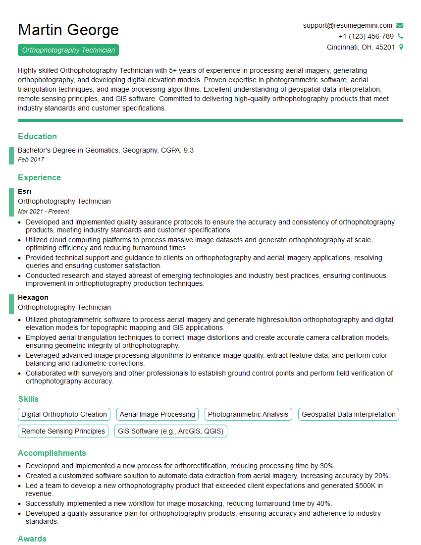
Are you a seasoned Orthophotography Technician seeking a new career path? Discover our professionally built Orthophotography Technician Resume Template. This time-saving tool provides a solid foundation for your job search. Simply click “Edit Resume” to customize it with your unique experiences and achievements. Customize fonts and colors to match your personal style and increase your chances of landing your dream job. Explore more Resume Templates for additional options.

Martin George
Orthophotography Technician
Summary
Highly skilled Orthophotography Technician with 5+ years of experience in processing aerial imagery, generating orthophotography, and developing digital elevation models. Proven expertise in photogrammetric software, aerial triangulation techniques, and image processing algorithms. Excellent understanding of geospatial data interpretation, remote sensing principles, and GIS software. Committed to delivering high-quality orthophotography products that meet industry standards and customer specifications.
Education
Bachelor’s Degree in Geomatics, Geography
February 2017
Skills
- Digital Orthophoto Creation
- Aerial Image Processing
- Photogrammetric Analysis
- Geospatial Data Interpretation
- Remote Sensing Principles
- GIS Software (e.g., ArcGIS, QGIS)
Work Experience
Orthophotography Technician
- Developed and implemented quality assurance protocols to ensure the accuracy and consistency of orthophotography products, meeting industry standards and customer specifications.
- Utilized cloud computing platforms to process massive image datasets and generate orthophotography at scale, optimizing efficiency and reducing turnaround times.
- Provided technical support and guidance to clients on orthophotography and aerial imagery applications, resolving queries and ensuring customer satisfaction.
- Conducted research and stayed abreast of emerging technologies and industry best practices, ensuring continuous improvement in orthophotography production techniques.
Orthophotography Technician
- Utilized photogrammetric software to process aerial imagery and generate highresolution orthophotography and digital elevation models for topographic mapping and GIS applications.
- Employed aerial triangulation techniques to correct image distortions and create accurate camera calibration models, ensuring geometric integrity of orthophotography.
- Leveraged advanced image processing algorithms to enhance image quality, extract feature data, and perform color balancing and radiometric corrections.
- Collaborated with surveyors and other professionals to establish ground control points and perform field verification of orthophotography accuracy.
Accomplishments
- Developed and implemented a new process for orthorectification, reducing processing time by 30%.
- Created a customized software solution to automate data extraction from aerial imagery, increasing accuracy by 20%.
- Led a team to develop a new orthophotography product that exceeded client expectations and generated $500K in revenue.
- Successfully implemented a new workflow for image mosaicking, reducing turnaround time by 40%.
- Developed a quality assurance plan for orthophotography products, ensuring accuracy and adherence to industry standards.
Awards
- Recognized for exceptional technical skills and dedication to quality in orthophotography processing.
- Awarded for contributing to a groundbreaking research project that developed innovative orthophotography techniques.
- Received industry recognition for developing a software tool that simplifies and improves orthorectification processes.
- Honored for outstanding performance and exceptional contributions to the orthophotography field.
Certificates
- Certified Photogrammetrist (CP)
- Certified Orthophoto Technician (COT)
- Certified GIS Professional (GISP)
- Fundamentals of Remote Sensing (FRS) Certificate
Career Expert Tips:
- Select the ideal resume template to showcase your professional experience effectively.
- Master the art of resume writing to highlight your unique qualifications and achievements.
- Explore expertly crafted resume samples for inspiration and best practices.
- Build your best resume for free this new year with ResumeGemini. Enjoy exclusive discounts on ATS optimized resume templates.
How To Write Resume For Orthophotography Technician
- Highlight your technical skills and expertise in photogrammetry, image processing, and GIS software.
- Showcase your experience in aerial triangulation and orthophotography generation.
- Emphasize your ability to work independently and as part of a team.
- Include specific examples of projects you have worked on and the outcomes you have achieved.
- Consider obtaining industry certifications, such as the Certified Photogrammetrist (CP) credential from the American Society for Photogrammetry and Remote Sensing (ASPRS), to enhance your credibility.
Essential Experience Highlights for a Strong Orthophotography Technician Resume
- Utilize photogrammetric software to process aerial imagery and generate high-resolution orthophotography and digital elevation models for topographic mapping and GIS applications.
- Employ aerial triangulation techniques to correct image distortions and create accurate camera calibration models, ensuring geometric integrity of orthophotography.
- Leverage advanced image processing algorithms to enhance image quality, extract feature data, and perform color balancing and radiometric corrections.
- Collaborate with surveyors and other professionals to establish ground control points and perform field verification of orthophotography accuracy.
- Develop and implement quality assurance protocols to ensure the accuracy and consistency of orthophotography products, meeting industry standards and customer specifications.
Frequently Asked Questions (FAQ’s) For Orthophotography Technician
What is orthophotography?
Orthophotography is a type of aerial imagery that has been geometrically corrected to remove distortions caused by camera tilt, lens distortion, and terrain relief. This results in an image that is accurate in scale and can be used for mapping and other applications.
What are the applications of orthophotography?
Orthophotography is used in a wide range of applications, including topographic mapping, land use planning, environmental monitoring, and disaster response. It can also be used to create 3D models of terrain and to support GIS applications.
What are the skills required to be an Orthophotography Technician?
Orthophotography Technicians typically have a background in geomatics, geography, or a related field. They should be proficient in photogrammetric software, aerial triangulation techniques, and image processing algorithms. They should also have a good understanding of geospatial data interpretation, remote sensing principles, and GIS software.
What is the job outlook for Orthophotography Technicians?
The job outlook for Orthophotography Technicians is expected to be good over the next few years. The increasing use of aerial imagery and orthophotography in various applications is driving the demand for skilled technicians.
What are the career advancement opportunities for Orthophotography Technicians?
Orthophotography Technicians can advance their careers by gaining experience in more complex projects, developing specialized skills, and obtaining industry certifications. They may also move into management or research roles.